Mount Ulap
a Mountain Peak
altitude of (1846 masl)
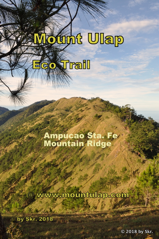
"Mount Ulap ❌ lies at an altitude of (1846 m above sea level) within the Ampucao-Santa Fe mountain range. The Mount Ulap Summit is reachable after 6.5 km and a hiking time of 4 hours on the Mount Ulap Eco-Trail mountain path from Ampucao in Itogon, Benguet, Philippines. "
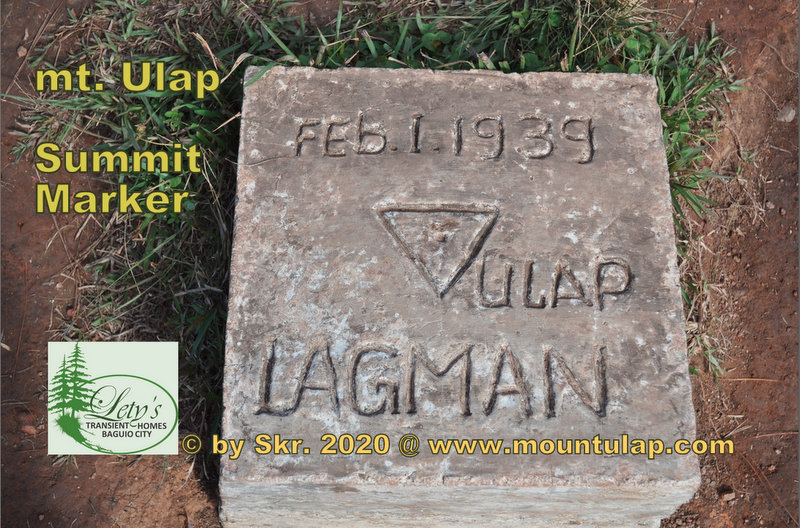
Mount Ulap Summit marker
at the
Ampucao - Santa Fe mountain ridges
Introduction
Hiking Notes
Location ❌ : Along the Mt. Ulap Eco-Trail mountain path within the Ampucao-Santa Fe mountain range at a height of 1846 meters above sea level at a hiking distance of 6.5 km and after a hiking time of 4 hours lies the Mount Ulap Summit in Itogon, Benguet, Philippines.
Why it is called ❌ Mount Ulap?:
Mount Ulap (the Name "Ulap" is in Filipino means CLOUD), which literally means in Engl cloud mountain.
At dawn, most of the time, the mountain top is surrounded by a sea of clouds when the fog is rising from the valleys left and right at twilight.
As the Legend told our ancestors had a different name in their folklore for the mountains where there are living in.
Around February 1, 1939, after a preliminary survey was done by the engineer named "LAGMAN" along the old mountain path finally named the third and highest peak at 1,846 m above sea level on the Ampucao Santa Fe Ridges was called "ULAP" and the Summit Marker was placed on the peak.
What is Mt. Ulap known for? :
Mount Ulap, ❌ a mountain peak that mountaineers also called the summit, is a hiking paradise for young and old.
With a towering height of 1864 Meters above sea level.
People come from all over the compass, and regardless of their social background, people move to the mountains on weekends and holidays to breathe the fresh and clean mountain air to reduce the stress of modern life.
How many km is ❌ Mt ulap?:
Clarification, Mt. Ulap is a Mountain Peak and not a hiking trail.
The hiking route on the Eco-Trail along the Ampucao Santa Fe Mountain ranges to Mt. Ulap Summit is 6.5 km from Jump on Point and can be covered in about 4 hours.
What province is ❌ Mt. Ulap?:
With a towering height of 1846 meters above sea level. The Mount Ulap Summit is located within the Ampucao Santa Fe mountain ranges in the Cordillera Administrative Region in Benguet Province, Philippines.
Evolution:
During the past 2.5 million years, continents shifting and colossal ice sheets gripped the globe, perhaps 15 different times. Glaciers sculpted about one-third of the earth’s landmass. Tectonic plates are in motion, vulcanos lifting landmasses and creating a mountain range.
The Cordillera Mountains are not where archaeologists find ancient graves or hidden treasures nor the destination for dinosaur fossils or remains of other species that we have not seen for millions of years.
In other words, there were no dinosaurs in the Philippines because, in the first place, there was no Philippines during the time of the dinosaurs. The Philippines came into existence as an archipelago about ten million years ago, during the Pleistocene Epoch. The first Philippine island likely surfaced nearly 60 million years ago – about five million years after the last of the dinosaurs died out.
Background:
Unknown to the day hikers that the Mount Ulap Eco-Trail is an old mule track, known only to local shepherds and mountain farmers, which is ascending slowly up and down over hill and dale, which starts at the Ampucao Barangay Hall and winds along the Ampucao Mountain Ridge passing by the Gungal Rock up to the Mount Ulap Summit Peak 1846mASL and ending in a descending path through the Pinewood forest in Sta Fe Exit Point.
Elevation:
* Mount Ulap Summit 1846 mASL
Distance:
* 6,5km from Ampucao Barangay Hall
Hiking time:
* hiking time: 4.0h
Experience:
A day hike on the way to Mt. Ulap Summit is technically the easiest to climb to the summit. You don't need ropes, special mountaineering equipment, or any previous mountaineering experience, a frequented tourist spot
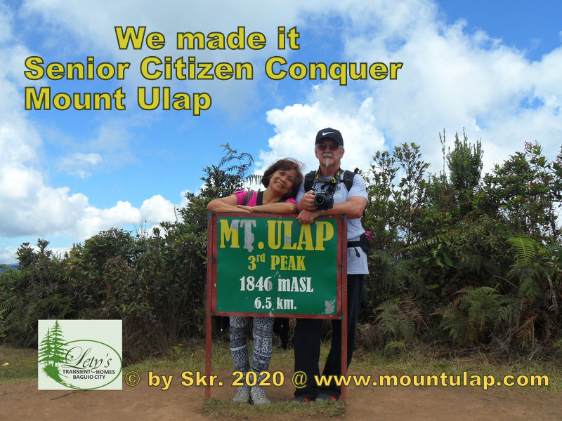
Mount Ulap
Summit
3rd Peak
Mount Ulap Summit is a day hiking adventure on the Eco-Trail from Ampucao to Santa Fe Exit in Itogon, Benguet.
✅ Time, Distance & Elevation
* hiking time: 4.0h
* distance: 6.5km
* elevation of: 1,846 mASL
❌ Two Senior Citizens ascending in a 4h hiking tour and Conquer the Summit of Mount Ulap. Finally, there reach the Summit Marker of Mount Ulap by hiking an old 6.5km mountain path snaking through this remote ancient mountain range via the Ampucao Santa Fe Ridge, located in Itogon, Benguet, Philippines.
🚩 Conquering Mount Ulap Summit and hiking the Eco-Trail is not an insurmountable hiking path that was already proven by Senior citizens as well as young children.
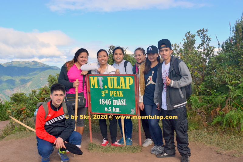
Mountaineers
at
Mount Ulap Summit
Day Hiking on the Eco-Trail, to Mt. Ulap Summit, a frequented tourist spot
✅ For Mountaineers and Adventurists ain't no mountain high enough have used the mountains as a remedy for the stresses of modern life.
📌 People come from all over the compass, and regardless of their social background, people move to the mountains on weekends and holidays to breathe the fresh and clean mountain air.

Eco-Tourism
at
Mount Ulap Summit
Eco Tourist on the Eco-Trail, to Mt. Ulap Summit, a busy tourist destination
✅ From the sun-soaked beaches of Palawan to the provincial city of Laoag City in Ilocos Norte, of the Philippines, thousands of tourists across the Philippines are finding their dream hiking vacations every year at Mount Ulap Eco-Trail hiking on the way to Mt. Ulap Summit, a busy tourist destination.
📌 What do you want to achieve is to hike the trail in no time for sporting reasons?.
Or hike during dawn and witnessing a stunning sunrise over the Cordillera mountains, or you hike above a sea of clouds, or to see a beautiful sunset or camping under a starry sky.
All of this the Mount Ulap Eco-Trail has it.
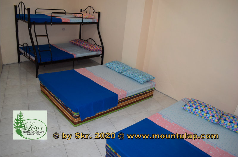
Transient House
near
Mount Ulap
Affordable & Budget-Friendly Accommodation
in Baguio City
near PMA, Loakan Baguio Airport,
Camp John Hay, Mt. Ulap
📌 After a day of exploring 🚶the Eco-Trail, what better way to reward yourself than by relaxing at a cozy Transient House
✅
🚩 Lety's ❌ Transient House near Mt. Ulap is the perfect place for families and groups of up to 40 guests.
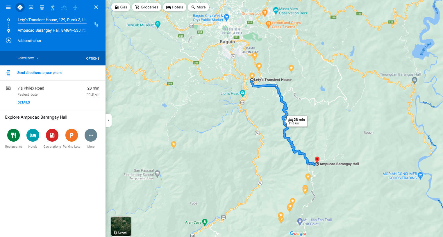
🚩 Lety's ❌ Transient Homes in Baguio is a 28-minute drive from your destination, Mount Ulap Eco-Trail, and proudly calls itself a friend of the Eco-Trail.
